
Track
See where ticks have actually been reported.
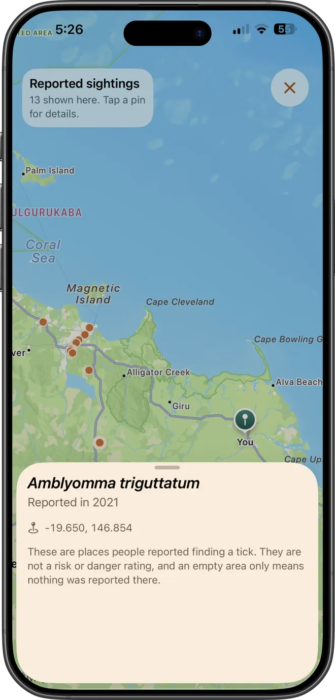
An offline map of reported tick occurrences worldwide, drawn from occurrence records and clustered as you zoom in. Tap a cluster to break it apart and read individual reports.
Download on the App Store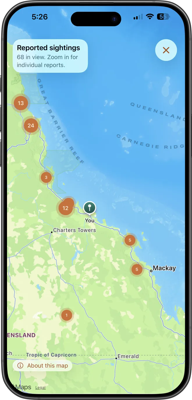
Works offline
The dataset ships with the app, so the map works with no signal, which is usually exactly where you need it.
Clusters as you zoom
Counts collapse into clusters at low zoom and break apart into individual records as you move in.
Species and date per record
Individual reports carry the recorded species and the year it was logged.
What it does not do. This is a map of where ticks have been reported, not a risk or danger map. Reporting density reflects where people submit records, often near cities and research sites, so an empty area means nothing was reported there, not that ticks are absent.
Common questions
- Does it show ticks near me right now?
- No. It shows historical reported sightings from occurrence records, not live or current activity, and not a personal risk level. Treat sparse areas as under-reported rather than tick-free.
- Where does the data come from?
- Compiled occurrence records: observations of ticks logged by researchers and the public, combined into a single offline dataset.